Ex-Tropical Cyclone Alfred live: Queensland faces ‘biggest loss’ in power in over a decade from ex-cyclone
Stay up to date with the latest emergency warnings

ABC Emergency will broadcast regular warnings on ABC Radio. You can find more information, including a map of all the warnings, by clicking here.
- Brisbane — 612 AM, 106.1 FM and Digital Radio
- Gold Coast — 91.7 FM and Digital Radio
- Sunshine Coast — 90.3 FM and 95.3 FM
- Tweed, Lismore and surrounds — 94.5 FM
- Grafton — 738 AM
- Coffs Harbour and Mid North Coast — 92.3 FM and 684 AM
- Port Macquarie — 95.5 FM
- Taree — 756 AM
You can also find these stations on the ABC Listen App.
Almost 400 people in evacuation centres across the south-east

Mr Chelepy says 34 evacuation centres remain open, with 396 people currently staying there.
“And I’ve been advised through the disaster network that those evacuation centres will remain open, particularly as we move into the threat of flood-related issues,” he says.
No loss of life or missing persons in Queensland
Acting Police Commissioner Shane Chelepy says there has been no loss of life or missing persons as a result of the weather event.
“Which is frankly terrific at this stage,” he says.
Emergency services were called out to “a large number of jobs” across the Gold Coast and Brisbane areas overnight due to downed powerlines and trees.
“We did see an a apartment complex on Labrador on the Gold Coast suffer damage,” he says.
“Twenty-one persons were safely evacuated from that apartment complex and are now in our evacuation centres, with one lady suffering minor injuries, but she is in good health.”
Mr Chelepy says there were no “significant reports” of damage to houses or infrastructure on Stradbroke, Moreton Island or the lower bay islands as the system moved over.
Localised rainfall of over 800mm possible in some areas of the south-east
Mr Collopy says rainfall totals of over 250 millimetres have already been observed around the Scenic Rim.
Widespread totals of 100 to 200mm have been recorded on the Gold Coast, “stretching up into the southern parts of Brisbane”.
“As the remnants of … Alfred moves inland, we will see more tropical moisture streaming across south-east Queensland and we are expecting widespread totals of 300-500mm, with localised amounts of 800mm plus possible in some areas,” he says.
“In terms of the flooding, that heavy to intense rainfall is expected to produce the risk of dangerous and life-threatening flash flooding, and widespread minor to major riverine flooding across much of the south-east.”
Ex-Tropical Cyclone Alfred expected to move inland over the next 12-24 hours
Matthew Collopy from the Bureau of Meteorology is speaking now.
He says ex-Tropical Cyclone Alfred is now expected to move inland over the next 12 to 24 hours, and will track north of Toowoomba and further inland by this evening.
A severe weather warning remains in place across the south-east, with the risk of locally heavy to intense rainfall and the potential for damaging wind gusts continuing.
“The primary concern within the severe weather warning is for those locally intense and very heavy rainfall amounts,” Mr Collopy says.
“But there is also the chance of damaging wind gusts with the system, or with the rain showers and thunderstorms as the system moves inland.”
A ‘race against the clock’ to reconnect power to water treatment plants
Mr Crisafulli says the Gold Coast University Hospital remains without mains power and has been running on generators.
“But there are a number of other key bits of infrastructure where we need to urgently re-attach power to,” he says.
The water treatment plants at Mount Cotton and Alexandra Hills are without power, with generators on site and staff urgently attempting to reconnect those, he adds.
“And it is a race against the clock to try to do that in the minutes and hours ahead before those reservoirs run out of water,” he says.
Mr Crisafulli says the 32 remaining water treatment plants are working.
‘Single biggest loss’ in power in Queensland in over a decade
Mr Crisafulli says almost 250,000 homes are without power.
“That’s the single biggest loss we have seen in over a decade since Oswald,” he says.
“The work needed to reconnect that is significant, but the ability and the desire of the men and women who will do it is without peer.
“Queenslanders need to know know that right now there are damage assessments being done and already crews are being mobilised to get that job done.”
Mr Crisafulli says 1,200 staff from Energex were prepositioned in anticipation of Albert’s landfall, and they will be joined by 800 staff from Ergon.
“A quarter of a million homes without power is a massive task, but it is a massive task that they are up to.”
Large rainfall totals recorded across the south-east
Mr Crisafulli says the storm tide surge did not eventuate, but the next big challenge will be rainfall.
Over the past 19 hours, 240 millimetres was recorded at Springbrook, 200mm at Tallebudgera and 100mm at Mount Cotton.
“The challenges now are flash flooding, creek rises. They remain a real prospect with some of the rainfall predicted in the days ahead,” he says.
“We have to be ready for that prospect. With swollen catchments, the risk of flash flooding remains, I’m asking Queenslanders to continue to stay vigilant.”
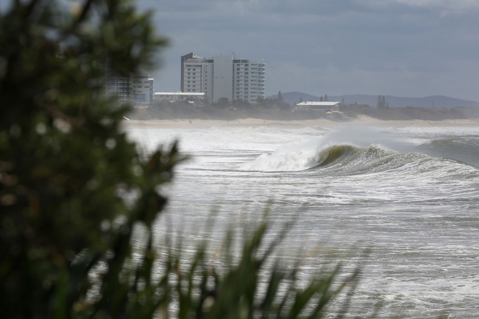
Alfred downgraded but still ‘significant challenges’ ahead
Queensland Premier David Crisafulli says while ex-Tropical Cyclone Alfred has been downgraded to a tropical low, “there are still significant challenges ahead”.
“Those four key challenges — waves, wind, rainfall and flooding — have been those four stages that different areas have worked through at different times,” he says.
Mr Crisafulli says overnight wind speeds of 107 kilometres per hour were recorded at the Gold Coast seaway, 93kph at the Brisbane Airport and 85kph at Redcliffe.
“We have seen some damage to some buildings. We’ve seen the loss of a roof off one of the apartment buildings, one of the older buildings on the Gold Coast,” he says.
“We’ve had quite a few instances of trees falling on homes, cars and powerlines.”
WATCH LIVE: Queensland premier gives an update on ex-Tropical Cyclone Alfred
You can watch live using the YouTube stream below or follow along on the blog.
Fifteen people evacuated after roof blows off Labrador building

Police evacuated about 15 people from an apartment complex in Labrador on the Gold Coast overnight after the roof was blown off by strong winds caused by ex-Tropical Cyclone Alfred.
One woman was taken to hospital with minor injuries and the others were taken to the Burleigh Heads Evacuation Centre.
Loading…
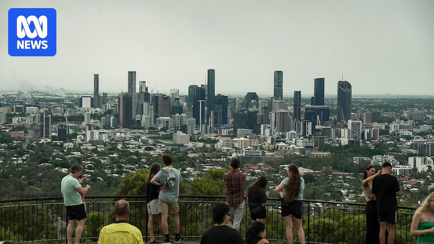
‘Where’s Alfred?’: North Stradbroke Island waiting for full impacts

North Stradbroke Island resident Kylie Taylor says it’s been a calm morning as the community awaits the full impact of ex-Tropical Cyclone Alfred.
Residents on the Island lost power around 9pm last night and trees are down, but she says she slept pretty soundly through the night.
Loading…
Ms Taylor is the owner of a small brewery on the island and says it’s been a blow to business having no boats coming in since Wednesday.
She says as soon as it’s safe to do so, they’ll open up one of the floors to put on pizzas for locals.
‘I cried a bit in relief when I heard that Alfred had been downgraded’
Thanks for your messages this morning, we’re glad to hear you’re all staying safe.
How are things looking in your patch? You can drop us a line using the comment form above.
I cried a bit in relief when I heard that alfred had been downgraded to a low. With any luck the rain won’t be as heavy as expected either. I can hear a bird chirping away outside. 🙂 — Vicki
Well both toddlers woke up at about 10-11pm from the winds, and we could see it gearing up so took shelter, but it really didn’t get too bad here (Oxley). Feeling pretty lucky right now that the worst affect I’ll personally experience from the storm is a bad night’s sleep and a wet week. — Tara
All good here in hope island/ helensvale. Still have power, the canal is as full as I’ve ever seen it though. Just keeping an eye on it… — Olivia
We are on Bribie island so far so good! I’ve had Just made a cuppa still have power for now no thunder or lightning yet which is weird — Lee
Northern Rivers town avoids major flooding but remains without power
Tumbulgum in northern New South Wales appears to have been sparred major flooding overnight, though the town still remains without power.
The Tweed River is currently sitting at minor flood levels of 1.8 metres, but the Bureau of Meteorology is forecasting it could reach major flood levels of 2.5 metres by late Saturday morning.
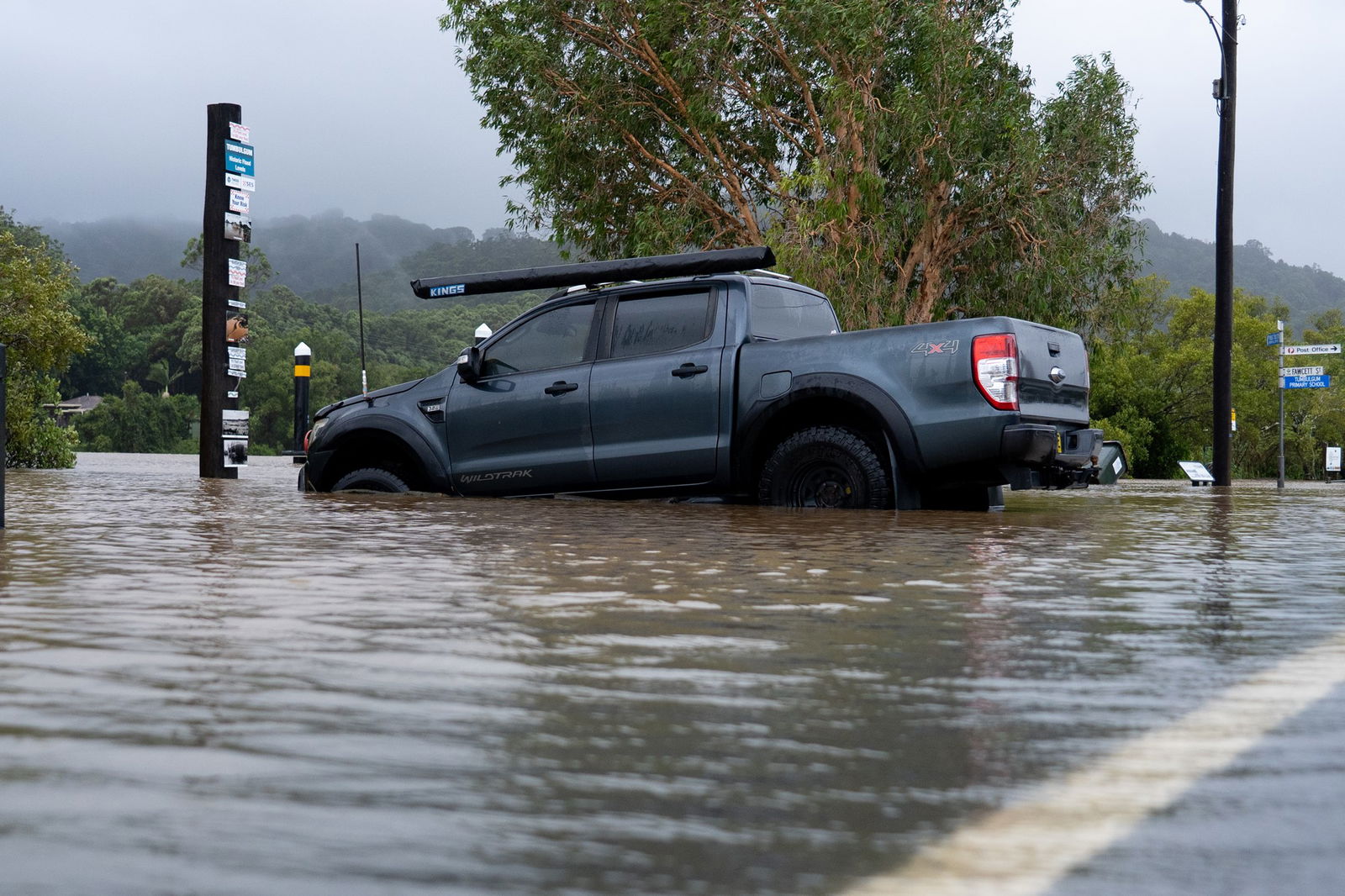
The town experienced some minor flooding in low lying areas but is mostly unscathed.
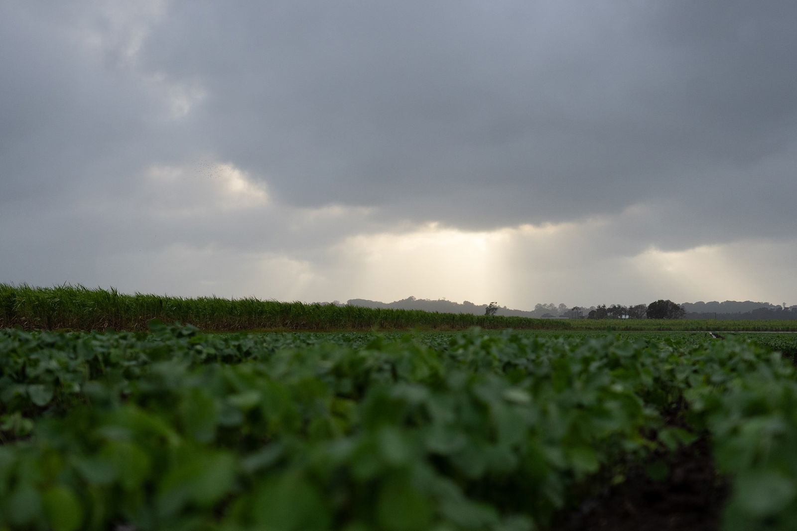
Soy bean crops near Murwillumbah have also survived the windy and rainy night.
There are also major flood warnings for the Tweed River at Tumbulgum, Nambucca River and Richmond River at Kyogle, Coraki Woodburn and Bungawalbyn.
Reporting by Victoria Pengilley
Energex crews waiting for break in conditions to begin work
Over 200,000 energex customers in Queensland’s south-east are currently without power.
Some Gold Coast residents have been without power for longer than 24 hours now.
Energex General Manager Chris Graham says it hasn’t been safe to get crews out to do work yet, but they are ready to go.
“In the south-east we have around 1,200 crews and we’ve also got a significant number of support staff too,” he says.
After a lengthy build up, the rain has arrived
Reporting by Robert Burgin on the Sunshine Coast
After a lengthy build up, the Sunshine and Cooloola coasts can expect between 50 to 100 millimetres of rain in the next 24 hours, with some isolated pockets potentially receiving up to 200mm.
Bureau of Meteorology senior forecaster Dean Narramore says there could be flash and riverine flooding.
“There will be locally intense rainfall from Gympie south,” he says.
Cyclone Alfred downgraded to a tropical low — what does it mean?
ABC meteorologist Adam Morgan has unpacked it with News Breakfast:
Loading…
Essential Energy warns of damaged electricity wiring as tens of thousands left without power
Reporting by James Tugwell
Essential Energy is warning customers to avoid damaged electricity wiring after a customer in Byron Bay received a shock from a submerged underground electricity pillar.
Operational managerMark Summers told ABC Radio that 39,000 residences are without power this morning, but residents should remain wary of all electronics and wiring.
“Just a reminder that all electricity networks must be treated as alive,” he says.
“Please make sure you stay well clear of it — at least eight metres from fallen power lines.”
He said the customer received a zap off the pillar they were touching at the time, which was submerged in water, but was otherwise uninjured.
“Obviously water and electricity don’t mix.”
Report any fallen power lines to Essential Energy’s emergency number: 13 20 80.
Lismore residents brace for impacts of ex-Tropical Cyclone Alfred
For residents in Lismore who still have the trauma and hardship of the 2022 floods fresh in their minds, it’s been an agonising wait for ex-Tropical Cyclone Alfred.
Resident Elise Derwin says there has been a lot more time to prepare for flooding and extreme weather conditions this time.
Loading…
“A lot of people have been able to get out of the CBD, they’ve packed up all of their things, put them in trucks, taken them out of town and a lot of residents have been ablet o pack up their homes,” she says.
“There’s definitely a lot of anxiety around the town not knowing how much of a major flood it’s going to be.”
It’s been an anxious night for some of you
Thanks for sharing your experiences with us this morning — you can let us know how you’re holding up using the comment form above.
It’s now a tropical low and no longer a cyclone, I’m so glad because reliving what that gc tornado was like, no thanks — Lucas
Light rain and occasional gusts of wind at 6am in Neranwood behind Mudgeeraba. The fierce wind settled during the night and we’re just waking up to the blackout. Mudgeeraba creek flooded so can’t get out even if we wanted to. — Georgina
It was a wooly night for sure several hours listening to the wind and rain. We have a boat on the water at the Goldy looks like it’s OK. We’ve been fortunate still with power at Moggill! Stay Safe — Andy
Anxious night, listening to the strong winds and watching trees outside, keeping an eye on Canal water in our backyard. Hopefully we have past the worst. Praying for all those who are badly affected — Semi
Thanks for the regular updates. Working at evac centre in Moreton Bay and all calm here and relieved at the current state of play. Hope the forecast prolonged rain doesn’t materialise. — Jo